(Note: there are many downloadable files embedded in this posts. Click on the blue links!)
York South/Weston is situated within the The Humber River Watershed. The Humber River bounds the ward to the west, while Black Creek bisects the ward, beginning in the north-east and eventually flowing into the Humber in the south-west. Constructed water systems in the ward include: sewers, including storm sewers which collect surface flow through catch basins, and combined sewers which add effluent to the mix; and water mains, which bring municipal water to taps and fire hydrants. There are about 12000 catch basins and 2000 fire hydrants in the ward.
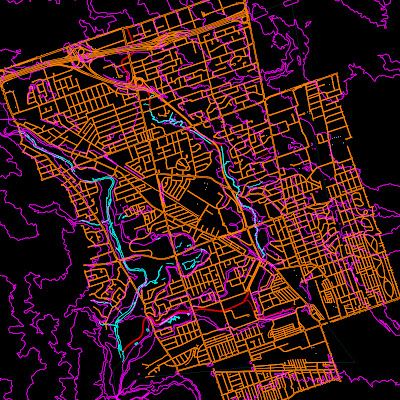
My Tracing represents the primary tool of the architect: AutoCAD. By overlaying the systems in question - surface topography, watercourses, catch basins and surface channelization (curbs), we obtain a seemingly objective representation of the water situation in York South/Weston.


The tracing provides no points of entry, no lines of flight, and is particularly illegible to the non-architect. In order to plug this tracing back into the map, I performed a second operation, an operation for which the tracing was an essential step. I created a milled 3D model of the ward, at 1:25,000 scale.
On one surface, the topography is represented, with a 10x exaggerated vertical scale.
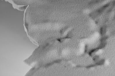
Here's a detail showing Eglinton Flats and Black Creek, which both drain into the Humber.
On the bottom, the major elements of the storm-sewer system are represented.
The map is meant to be directly instrumental. By pouring water on either surface, the user directly experiences the flow of water on the site, and the rhizomatic nature of natural flow in contrast to the arborescent nature of constructed flow. This characterization is true to reality. Surface run-off and groundwater percolation are highly multi-variate, non-linear and unpredictable, with pockets of turbulence and huge variations in rate. Open channel flow, the type that occurs in a sewer system, has been intentionally devised to be as predictable, stable and smooth as possible. It's interesting to note that all constructed water systems (arborescent) ultimately flow into a natural (rhizomatic) water system.


I also discovered a group that explores Toronto's storm sewer systems. Their efforts are catalogued at The Vanishing Point .
In York South/Weston, we find the
Westview Greenbelt Drain, Interestingly, Carl recalls exploring this drain as a youth. Its access point is shown below.
Wednesday, January 16, 2008
Tracing and Map: Water
Labels: Jesse, Section 1: Matters of Urbanism
Subscribe to:
Post Comments (Atom)

No comments:
Post a Comment